Northern Land Solutions (NLS) is a multidisciplinary consultancy servicing the surveying, planning and land development industries of northern Victoria and Southern NSW
Northern Land Solutions (NLS) is a multidisciplinary consultancy servicing the surveying, planning and land development industries of southern New South Wales and northern Victoria. With over 17 years of professional experience in regional and rural Victoria and NSW, NLS provide expert project services in the following fields: Registered Surveyors (NSW), Licensed Surveyors (VIC), Engineering Surveyors, 3D Scanning, Aerial Survey (LIDAR Drone), GNSS, Bathymetric Survey, Town Planning, Project Management, Land Development Advice and Machine Control Advice.
Northern Land Solutions’ head office is located in Swan Hill and visiting office located in Kerang and Balranald. Our staff are committed, and our comprehensive range of services is based on a combination of tertiary training, experience, technological innovation, practical experience with a range of projects and technologies, the benefits of local knowledge and ongoing professional development. We are driven to succeed, and our advice is sourced from high quality information and expert understanding across the many aspects of the land development and construction industries.
Northern Land Solutions offers the following services and expertise to individuals, small companies, major corporations, government authorities, mining companies, planners, solicitors, real estate agents, engineers, construction contractors and land developers:
Our positive, professional and modern approach allows us to work seamlessly with all servicing professions involved in the land development industry to ensure positive project outcomes, including:
Northern Land Solution staff are appropriately qualified to meet our clients land surveying requirements. By result of our commitment to professional development, NLS have Licensed Surveyors in Victorian and Registered Surveyors in NSW to perform Cadastral Surveys under the relevant sections of legislation.
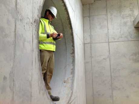
Staff of NLS have extensive training and experience with the use of the most sophisticated survey equipment available, including Trimble RTK GNSS, Robotic Total Stations, Scanners, Machine Guidance Systems, Bathymetric and Aerial Survey Systems. These technologies, combined with expert understanding of AutoCAD Software, Civil CAD, ArcView GIS, Pix 4D and Trimble Business Centre enable accurate computer drawn plans to be produced as either hard copy or in electronic format.
Please see herewith a summary of survey fleet & equipment available to Northern Land Solutions to assist:
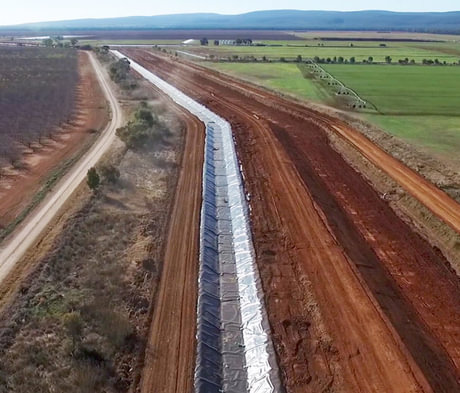
Our work is diverse. The experience we have gained by collaborating on a breadth of projects, and in conjunction with several reputable companies and government bodies has provided NLS with a vast variety of knowledge and understanding of the construction and environmental industries, in addition to private works. We pride ourselves on our collaborative approach and involvement in wide-ranging projects.
NLS has developed its professional skills base directed towards land surveying, town planning services and land development consultation. NLS is committed to providing professional services that meet individual client needs in an accurate, efficient and economical manner.
To achieve these aims, NLS has employed an internal quality management system involving comprehensive checks throughout initial survey and subsequent computations and plan preparations. This process is documented and held on file, as necessary, by regulatory requirements.
Our quality management system will continue to evolve and develop in line with continuous technology advancements, client expectations and industry direction.