The following is not a complete list, but is representative of the diversity of work carried out by Northern Land Solutions.
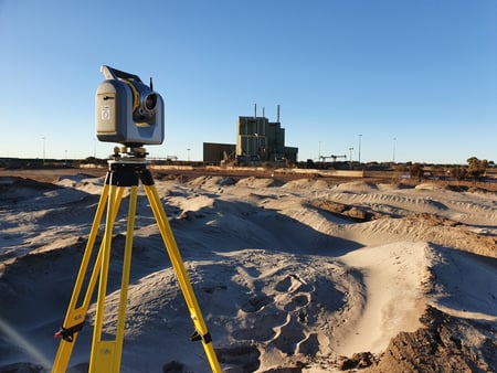
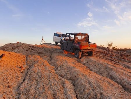
NLS have been involved in the above projects since their inception providing GNSSS contour, feature and level surveys (topographical survey), Control Survey, Title Re-establishment Surveys, Lease Plan creation, Civil Construction Set Out, generation and extraction of machine control files to assist GNSS aided machine control, preliminary marking of lease areas and title, pile set out, pile set out conformance survey to aid remodelling of array design
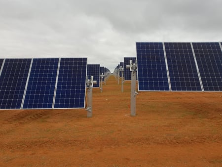
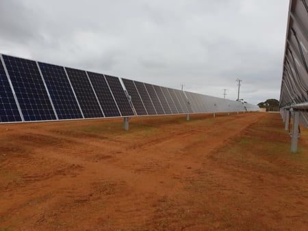
NLS have been involved in the Bannerton Solar project since its inception providing GPS contour, feature and level surveys, Title Re-establishment Surveys, Lease Plan creation, Civil Construction Set Out, assistance with machine control in constructing tracks, preliminary marking of lease areas, pile conformance survey to check pile contractor's machine control.
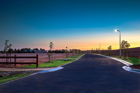
Licensed surveyor for Stages 8 to 12 of multi – lot residential subdivision in Swan Hill. Responsibilities Includes cadastral survey, feature and level survey, engineering survey, civil setout, contract management and liaising with statutory authorities.
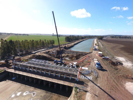
High order sub-contractor survey services for Principal Contractor, Comdain, for the construction of pump station, pump columns, pipeline, large regulating structures, penstock gates and levee banks. Survey tasks include control survey, horizontal and vertical survey control of constructed structures, as built surveys and verification plans deliverable to client.
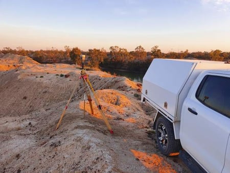
Ongoing sub-contracting survey services to GMW as required for capital works programme and irrigation modernisation. Survey tasks include channel cross section surveys, engineering surveys, structure surveys, bathymetric survey, 3D scanning, re-establishment surveys, acquisitions surveys and general feature and level surveys.
SA Water for Frenchman’s, Carrs and Bunberoo Creek Environmental Infrastructure including Infrastructure Engineering Survey, Cadastral Survey, Aerial Survey, Static Survey and Total Station Scanning:
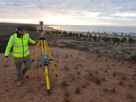
NLS have been recently engaged for project surveying services for NSW SDL project (via SA Water). Tasks include Static Control Survey linking Murray River Locks 7,8 & 9, digital levelling to achieve 3RD Order Control, Infrastructure Survey for 10 existing environmental regulators, bathymetric surveys for creeks, cadastral survey to identify property and riparian boundaries, total station scanning to produce point cloud 3D models, aerial survey (via drone) to produce 3D models in quantifying vegetation mass
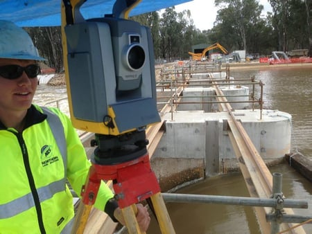
High order set-out survey required for the Euston Lock and Fishway Upgrade sub-contracted to McConnell Dowell Contractors and pier raising and refurbishment. Survey tasks include control survey, horizontal and vertical survey control of new pier locations, as built surveys and verification plans deliverable to client in complex riverine environment
Ongoing sub-contracting services of all forms of survey: Cadastral surveying, land subdivisions, re-establishment surveys, engineering surveys, engineering set-out survey, GPS survey, mapping and town planning.
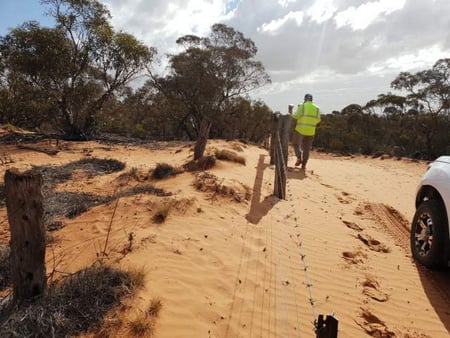
Re-establishment survey of bush land Reserves throughout the Mallee Region providing accurate locations of boundaries between private freehold land and Reserves for fencing purposes.
Tronox Mines, Atlas, Snapper, Ginko, Broken Hill MSP Mine
Registered surveyor responsible for Subdivision Acquisition surveys of new 35km road alignment for ‘Haul Road’ through Ivanhoe Plains. Further works were undertaken to create Mining Lease Plans for the Atlas Mine footprint. All plans were successfully lodged and now registered at NSW LRS. Further support supplied in road exchange subdivision at intersection of Roo Road and Knob Road along with monthly MSP Stock Pile Surveys in Broken Hill using aerial survey and total station scanning
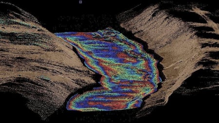
Bathymetric survey services of environmentally significant swamp lands providing NCCMA with critical information required for the development of Environmental Watering Plans, future environmental water management and monitoring undertaken at the wetlands including generation of rating tables, definition of littoral zones, Shapefile extraction and reporting for Pig Swamp, Johnsons Lake, Wirra-Lo wetlands, Lake Murphy, Lake Cullen, Little Lake Charm, Third Reedy Lake, First and Middle Marshes Lakes
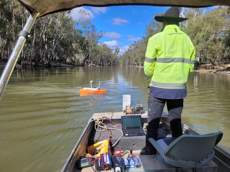
NSW DPIE Bathymetric Survey for Colligen Creek and Niemur River
NLS have been recently engaged for Bathymetric Survey for 120 km of Colligne Creek and Niemur River abutting Werai Forrest in conjunction with structure surveys. Tasks include AMSA Accreditation Training, Control
Curvey, AMSA Accreditation Training, sensitive Cultural Heritage inductions, bathymetric survey, structure surveys for 11 sites that impeded flows, data processing and GIS data set deliverables
TCHELERY Windfarm
Tchelery wind farm will host up to 120 turbines, making it an 800 MW wind farm, in the South-West Renewable Energy Zone (SW REZ). NLS have been recently engaged to undertake Control Survey, Title and Easement Re-establishment, Feature Survey for major intersections, Swept Path Analysis for 120m haul lengths needed to transport wind turbine components, verification for client supplied LIDAR data across 45,000 hectare site
Registered Surveyor responsible for subdivision of 80,000 ha historic Nulla, Noola & Lake Victoria Stations abutting Lake Victoria. This required the re-establishment and marking of approximately 170km of rural and remote boundaries and creation of conservation easements in an extremely challenging environment, generally relating to historic surveys of the late 1890’s. Eventual subdivision plans were produced and registered through Crown Lands Department as Western Lands titles
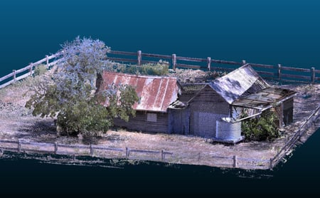
Parks Victoria 3D Modelling of Historical sites impacted by floods
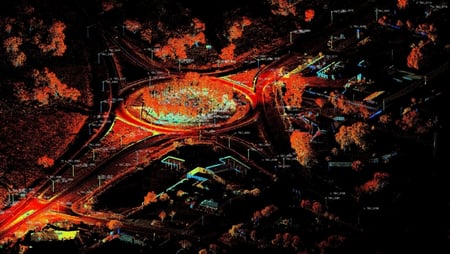
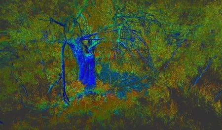
Northern Land Solutions have acquired new skills and technologies in producing 3D point cloud for architects, designers, water sector and mining clients using aerial survey and total station scanning. Such data platforms have been invaluable in producing high quality environmental rendering, extracting survey content itself and producing point clouds for volume computations and historical spatial preservation
NSW DPIE, Subdivision of Nulla and Noola Homestead
Registered Surveyor responsible for subdivision of 80,000 ha historic Nulla and Noola Stations abutting Lake Victoria. Requiring the re-establishment and marking of approximately 170km of rural and remote boundaries and creation
of conservation easements in an extremely challenging environment, generally relating to historic surveys of the late 1890’s. Eventual subdivision plans were produced and registered through Crown Lands Department as Western Lands titles
Point Cloud development: NLS have just recently been engaged to undertake full point cloud models for an existing and proposed regulator site in Wilcannia, NSW. Scope included full aerial survey, LIDAR terrestrial Scan,
bathymetry, topographical survey and third order levelling. Our client intends to utilise our developed point cloud for Virtual Reality projections and presentations to key stake holders such as Traditional Owner groups, other key government agencies and local stakeholders.
Project management, title re-establishment and identification survey for conversion of Yanga Station to National Park (~200,000 acres). This required the re-establishment and marking of ~ 170km of rural and remote boundaries in an extremely challenging environment, generally relating to historic surveys of the late 1890's. Arable land was also subdivided from the overall land holding and sold by auction.